Sometimes when looking through the many files collected by the Rochester Historical Society, serendipity occurs. I came across an old article entitled “Rochester Was Old When United States Was a Mere Infant.”
This is not just a talking point but an actual fact. While the United States is celebrating its 250th birthday, Rochester reached 340 years since its incorporation on June 4, 1686.
The article that I found begins with Native American names for four sections that became Old Rochester. They form a couplet:
Snipatuit and Monochessett
Sippican and Mattapeeset
It’s interesting to note that in 1647, liberty was granted to Plymouth to make “use of the land of Sippican for herding and keeping of cattle and wintering them.” That means that much of the land purchased by the original proprietors had simply been used for pasturage.
Nineteen years later in 1666, King Philip, Supreme Sachem of the Wampanoag Federations, gave permission for the Sippican lands to be sold. Those lands formed Old Rochester, and more was added when land in today’s North Rochester, previously purchased from Native Americans, was added to the town.
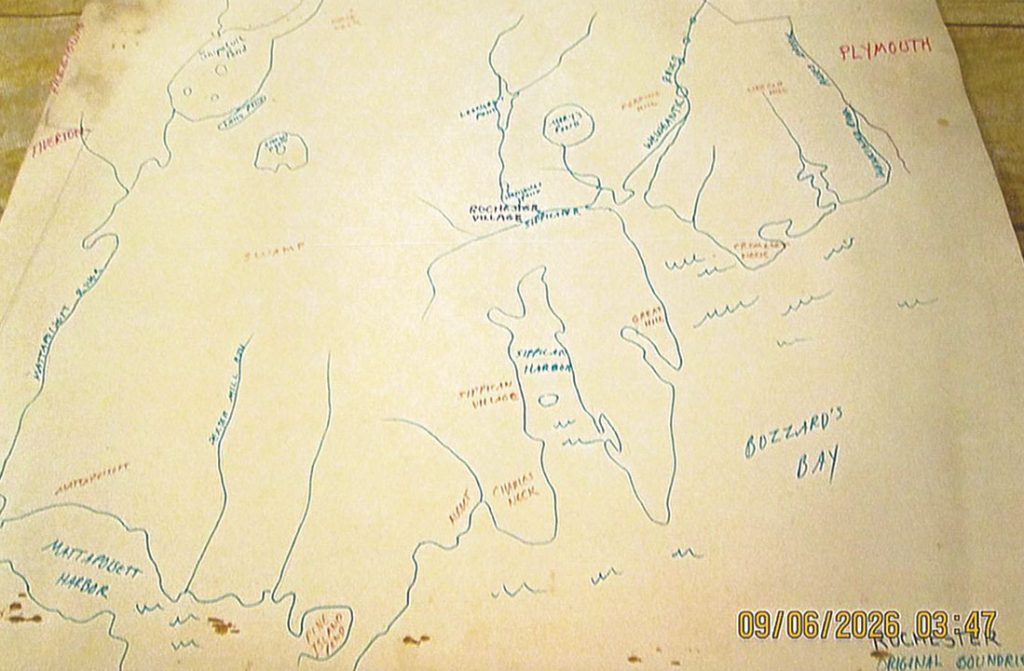
Old Rochester covered a much larger area than today’s Rochester, and now for the serendipitous part, I also found a hand-drawn map (shown here) that delineates the boundaries of Old Rochester. The abutting areas are Middleborough, Plymouth, Buzzards Bay, the Sippican and Mattapoisset harbors, and Tivertown, which was at some point folded into Freetown.
While the town today covers 32 square miles, it was much larger in the 1700s and the first half of the 1800s when it was known not just for its pine trees, bogs and fields, but also for its two harbors.
By Connie Eshbach