As we all know, Rochester is an old town with lots of history. Some of that history lives on in rocks and boulders throughout the area. Previously, we have mentioned both Witch’s and Devil’s rocks. Further back in the woods is another rock with a connection to the Native Americans who lived here. It is a large table rock, Indian Pound Corn Rock, which bears the marks made by Native American pestles that crushed the corn to make meal.
North Rochester is the site of Joe’s Rock. Located somewhere in the New Bedford Water Works, it contains a small cave said to have been the hiding place of a Revolutionary fugitive.
Many large or unusually shaped rocks became early boundary markers or were put to various other uses. A large rock in the area of Rochester known as Seppecan (today’s Marion) was a perfect formation for a pulpit. Known as Minister’s Rock, it was where the first minister of Rochester Township gave his first sermon in 1683.
In Rochester Center is Meeting House Rock, which bears a plaque that notes the location of the first meeting house built in 1699. Not far from there and across from Town Hall is the large rock formation that forms the Civil War Monument. These historical markers were often brought by a horse and team or other transport even though they weighed many tons.
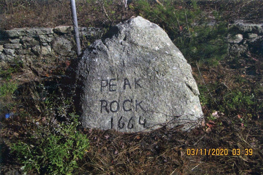
Boundary marker rocks were most often natural formations given a new job. One of these is Peak Rock shown in the picture. In 1664, the Court at Plymouth County designated this rock as the boundary between what would become Rochester in Plymouth County and Acushnet in Bristol County.
By Connie Eshbach