It was described as a skull-crushing storm by the national press, with an arctic blast so fierce that the ‘bomb cyclone’ was dubbed a ‘bombgenesis’ by meteorologists, and spread across social media like an atomic blitz.
On Thursday, January 4, the eastern coastline of Massachusetts and Cape Cod became Ground Zero with snow, flooding, and driving winds. However, Tri-Town was relatively spared most of the fallout, experiencing some rain, heavy wet snow, and winds knocking down arced, snow-caked power lines followed by a flash freeze.
Blizzard warnings went out Wednesday, and schools announced their closures before bedtime Wednesday night. Snow totals for our region were somewhat inflated compared to what actually fell – throughout this part of Plymouth County ranging from 5.8 inches in Rochester to over 6 inches in Acushnet and up to 13 in Middleboro.
The closest documented wind gusts Thursday were in Fairhaven at 46 miles per hour, not quite the blizzard strength winds that were forecasted, but power outages were almost immediate.
Marion opened up its emergency shelter at Sippican School as a warming center around 3:00 pm on Thursday, as 20 percent of Marion residences experienced power loss. It was then shut down two hours later at 5:00 pm when power was restored to the majority of Marion residences.
The storm was raging in the area just after noontime on Thursday, as power outages began to pop up as trees downed power lines. Eversource quickly dispatched its workers and restored power to most customers in Rochester and Marion.
“It was probably the best response we’ve seen in a while from Eversource,” said Rochester Police Chief Paul Magee.
But by 4:30 pm, Mattapoisett still saw over 1,800 customers without power, about 41 percent of Eversource customers.
There was one major accident on Interstate 195 West late morning on Thursday, with a vehicle striking a tree and three injured people taken to the hospital. Another Interstate 195 accident in the afternoon was minor.
Chief Magee said accidents were at a minimum during the storm, with only one vehicle reported to have slid off Walnut Plain Road.
“Traffic and accidents were pretty much off the table,” said Magee. “Most calls were just mainly trees and wires down.”
Magee credited the low number of accidents during the storm to schools, municipal offices, and businesses closing for the day, keeping people off the roads.
But then came the frigid cold temperatures that quickly soared down upon the heavy, wet snow that caked the roads, making some secondary roads nearly impassable.
Most accidents, said Magee, have occurred since the storm ended and road conditions deteriorated further after the sudden drop in air temperature, totaling eight between the end of the storm and Monday.
“That’s obviously high,” Magee said. “People are traveling too fast for the existing road conditions.” Not that they are speeding, he said, but that some roads were still in poor condition, coated with a thick layer of ice.
“There’s nothing [the Highway Department] could do about it. They’ve done everything they can, putting down sand and salt,” said Magee.
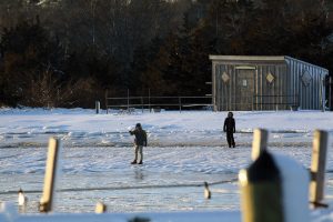
Along the Tri-Town coast, sub-zero night temperatures and below-freezing day temps finally solidified an already steadily chilling Buzzards Bay until it finally climbed above the freezing point on Monday, beginning the thaw that should stretch into next week, with warmer temperatures in the 50s predicted for the weekend along with some rain.
As of Thursday, January 11, there are exactly 67 days until spring.
By Jean Perry